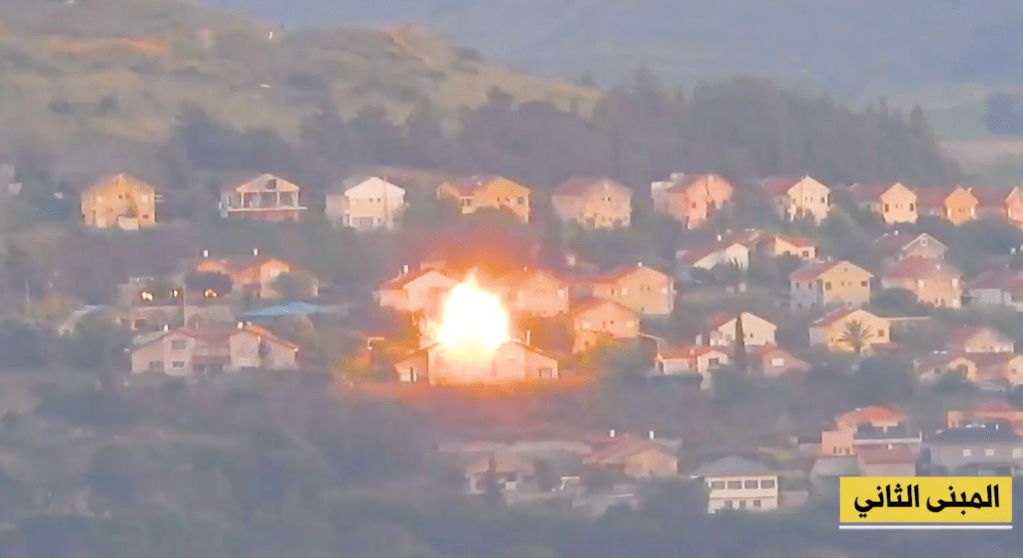
Hezbollah uploaded footage and claimed responsibility for an attack targeting two buildings in the Israeli town of Metula. The attack occurred on May 7, 2024, and did not cause any casualties according to Israeli sources.
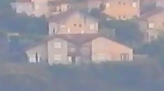
The video uploaded by the Iran-backed militia shows fighters firing an Iranian-made Toophan anti-tank guided missile into what appear to be two residential buildings in Metula. The Toophan is an Iranian reverse-engineered copy of the US made BGM-71 TOW anti-tank missile system.


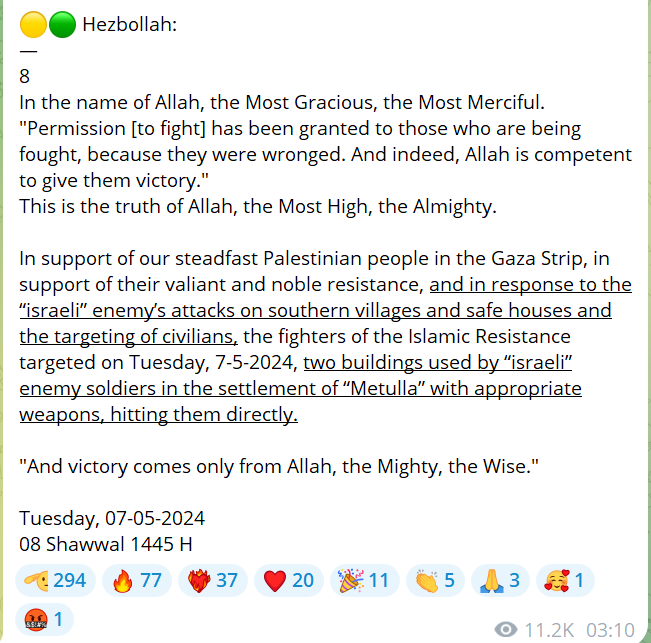
Hezbollah claimed in the following statement.
The full video of the attack can be viewed below.
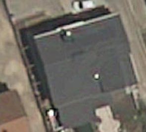
A photo showing the damage of the attack on one of the houses (house 2) was uploaded to social media.

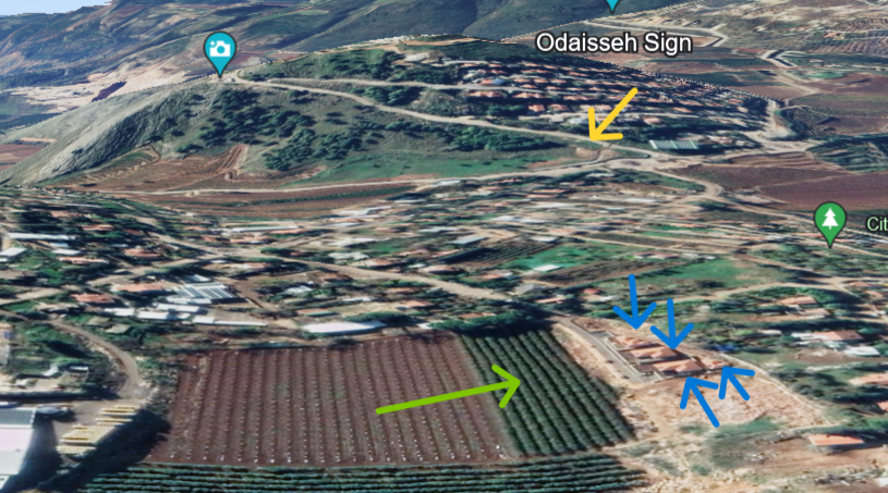
Geolocating the Attack
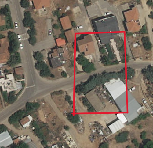
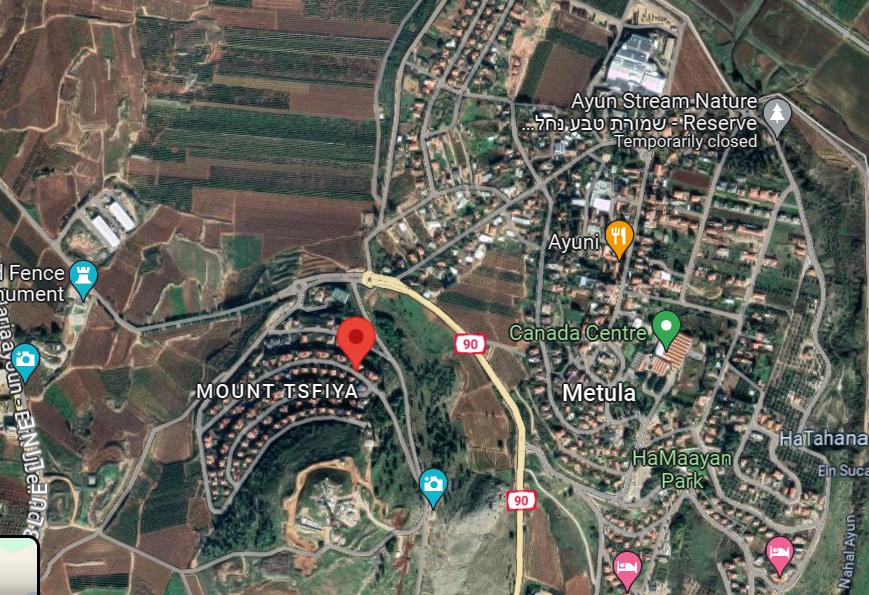
House 1:


The first missile hits a house or area north of a hill with a main road going down it and south of a farm/field with four buildings located close to eachother to the west.

Zooming in, we find three houses sitting in front of where the missile struck. The westernmost and easternmost of these houses have lighter roofs then the house in between them. The middle house appears to have solar panels, and the westernmost house appears to be taller than the other two houses visable.

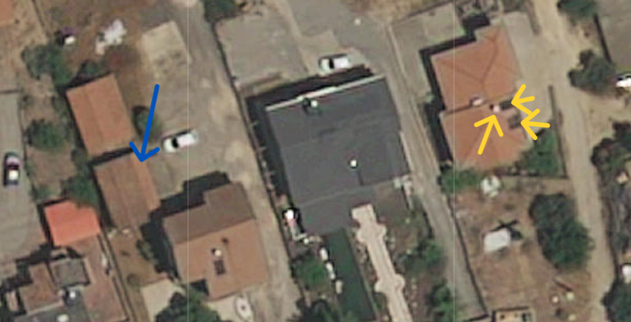
In this region of Israel, the best quality satelite imagery was taken in 2022, and although the houses surrounding the darker roofed middle house visually match the houses in the video, there are no visible solar panels which can clearly be seen in the video.
However, when switching to the lower resolution, but newer 2023 satelite imagery, there appears to be solar panels on the roof of the darker-roofed house.

With this information, the location of the first attack was geolocated to 33°16’52.8″N 35°34’29.1″E. Which house exactly was hit is unclear in the video published by Hezbollah. The missile most likely landed somewhere in the highlighted area in the picture below.
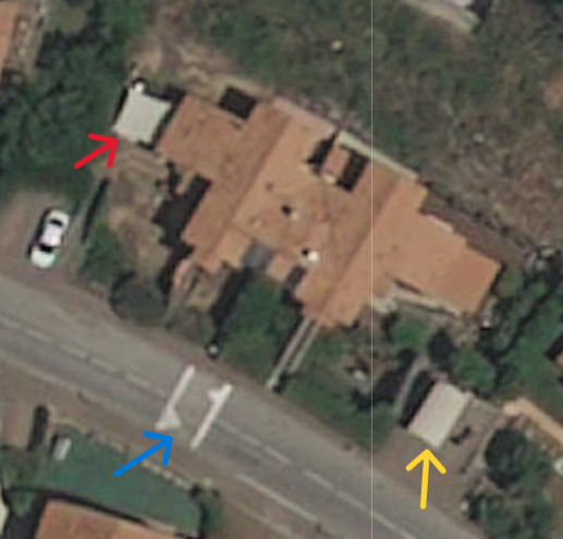
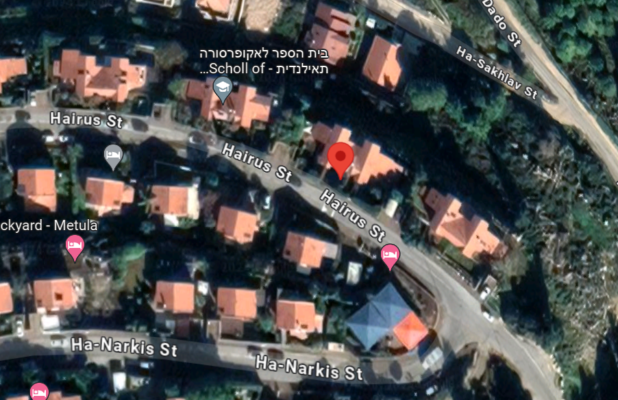
House 2:


It can be seen from these screenshots from the uploaded video that the house seems to visually match the aerial picture of the destroyed house uploaded to social media on the May 7.

Using these images, in conjunction with open-access Israeli government imagery, the image was geolocated to 33°16’39.8″N 35°34’20.3″E. The above image shows that the house is on the North of an East-West residential street (assuming the piucture was taken in the afternoon/evening).

Hezbollah do indeed seem to have hit two houses in the village of Metula as per their claim. Metula was evacuated in the early stages of the on-going war between Israel and Hamas due to Hezbollah attacks, with the IDF patrolling the city today. Whether or not these buildings were used by the IDF as claimed by Hezbollah is unknown.


Leave a comment